“Happy’s Point Gilas”
Click image for a closer view
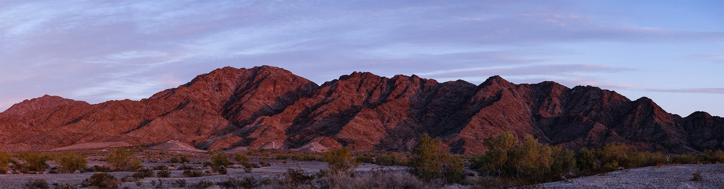
This image was made very close to a location on Google maps called "Happy's Point." That spot is just east of the corner of 56th St. (County 14 St.) and the southern end of Avenue 15E in the Foothills, about 14 miles east of Yuma, Arizona. Locals might recognize this view as what they see from the Foothills Executive and Foothills Par 3 golf courses.
The highest peak in this image might be called the "mountain with many names." It’s been known as Fortuna Peak, Flag Peak and Jester's Peak. It hosts the locally famous Jester's trail, which traverses the north side of the mountain. The trail isn't visible in the image, which was taken from the southwest. What is visible, if you look closely: the American flag at the top of the peak.
Width of printed image (no borders): 84.0 inches / 213.4 cm
Height of printed image (no borders): 22.0 inches / 55.9 cm
Date recorded: February 5, 2023
Image volume: 166,320,000 pixels
Composition: 12 individual photographs